Caves Uncovered: Exploring Their Varieties and How They Form

When most people think of caves, they imagine dark, underground chambers carved into rock, often filled with stalactites and stalagmites. However, the term “cave” encompasses a wide variety of naturally occurring structures formed through different geological processes.
These formations can vary significantly in size, shape, and origin, reflecting the diversity of environments in which they develop. Even among caves of the same type, there are notable variations influenced by local geology, climate, and the specific mechanisms driving their formation.
Caves are classified primarily by the processes responsible for their creation, including chemical dissolution, volcanic activity, mechanical erosion, and other natural forces. This classification reveals the complexity and variety of Earth’s subterranean landscapes, offering a fascinating glimpse into the planet’s dynamic geological processes.
What is a Cave?
A cave is broadly defined as a natural void in the Earth’s surface large enough for human entry. This seemingly straightforward definition, however, can vary depending on the region and the criteria used. While some definitions emphasize size, others focus on the geological processes that form the cave. These variations highlight the diversity of caves and the complexity of categorizing them.
Definitions of a Cave:
- General Definition: A naturally occurring cavity or system of cavities in the Earth, large enough for a person to enter.
- Regional Variations:
- In Europe, definitions often include measurable dimensions, such as a minimum length or depth, to distinguish caves from small crevices or overhangs.
- In North America, the definition is more inclusive, focusing on any naturally formed void, regardless of size, as long as it allows human access.
- In some regions, even shallow recesses or rock shelters are classified as caves, especially when they hold cultural or archaeological significance.
These differing interpretations underscore the fact that not all caves are deep, dark, or extensive systems. The term “cave” encompasses a range of formations with unique characteristics.
True Caves vs. Pseudo-Caves
Not all formations that resemble caves are classified as true caves. True caves are formed by geological processes such as chemical dissolution, volcanic activity, or mechanical erosion. In contrast, pseudo-caves are surface features that mimic the appearance of caves but do not meet the same criteria for origin or formation.
- True Caves:
- Formed through natural processes like the dissolution of rock, volcanic activity, or wave erosion.
- Examples include limestone solution caves, lava tubes, and sea caves.
- Pseudo- Caves:
- Formed by external forces such as weathering or the accumulation of debris.
- Examples include frost pockets, formed by freeze-thaw cycles, and spaces between boulders in talus slopes. While they resemble caves in appearance, their origins are distinct from those of true caves.
Variations Within Cave Types: Even within the same category, caves can vary significantly depending on the environment in which they form. For instance:
- Solution caves: can develop in different types of soluble rock, such as limestone, dolomite, or gypsum, and can range from small isolated chambers to extensive networks stretching for hundreds of kilometers.
- Lava tubes: may be smooth and tubular in basaltic flows but exhibit irregular shapes in regions with varied volcanic activity.
- Sea caves: may form in soft sandstone or harder granite, resulting in vastly different appearances and sizes.
These variations arise from differences in the local geology, climate, and the duration and intensity of the forces shaping the cave.
Caves, in all their forms, reflect the incredible variety and adaptability of Earth’s geological processes. Whether formed by dissolution, volcanism, or mechanical erosion, each cave tells a story about the environment in which it was created.
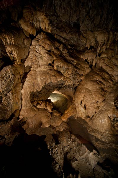
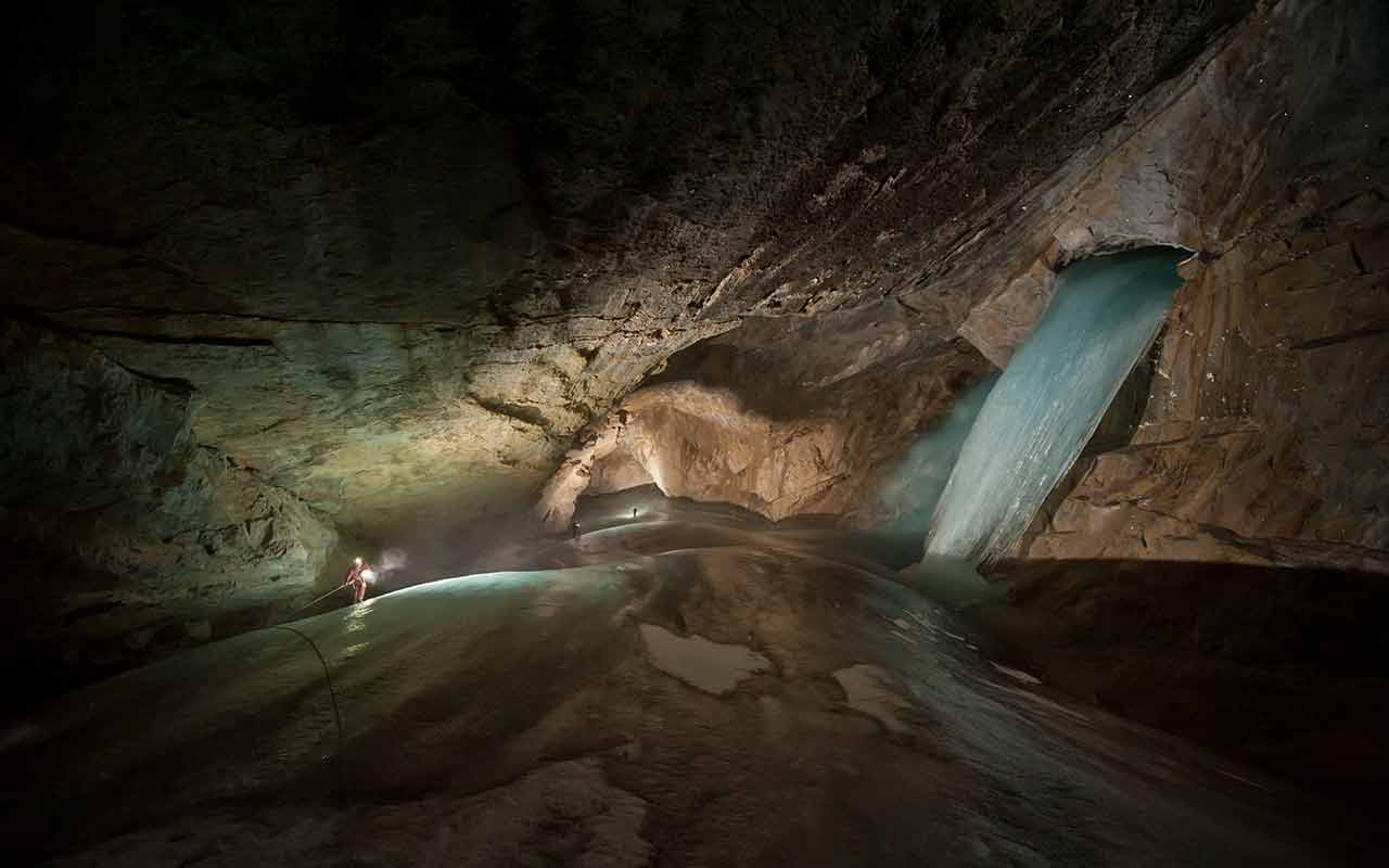
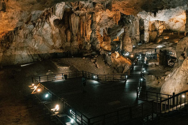
Caves Formed by Chemical Processes
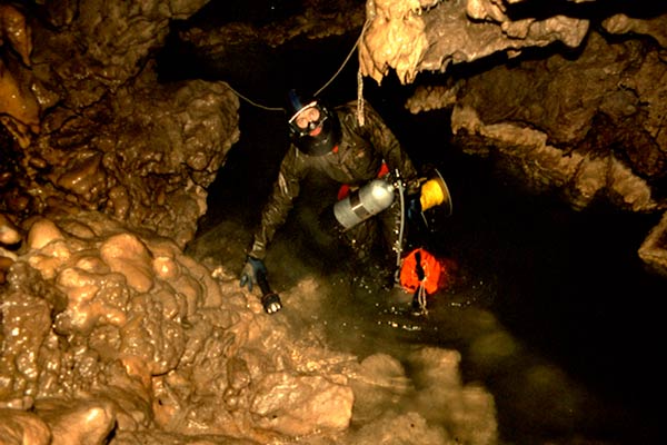
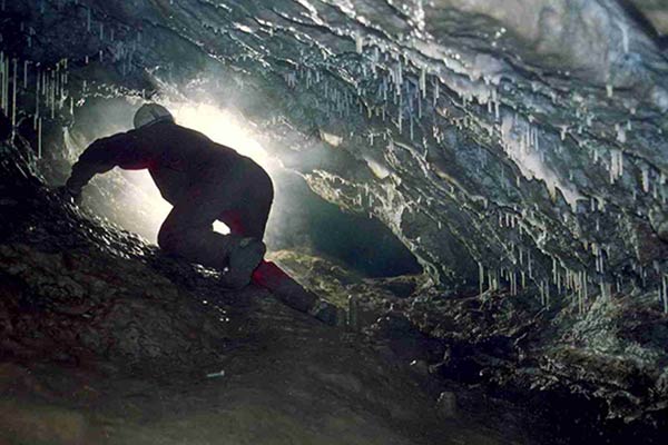
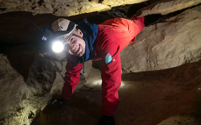
Caves formed through chemical processes, often called solution caves, are among the most common and extensive cave types worldwide. These caves are created when water interacts with certain types of rock, dissolving it over time and carving out voids and passageways. The primary mechanism behind their formation is the chemical reaction between slightly acidic water and soluble rocks, such as limestone, dolomite, and gypsum.
-
Grottes De Betharram, France
Grottes De Betharram, France
-
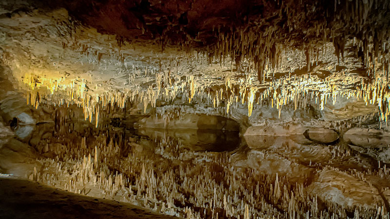
Luray Caverns, USA
Luray Caverns, USA
-
Manjanggul Cave, Jeju Si, South Korea
Manjanggul Cave, Jeju Si, South Korea
-
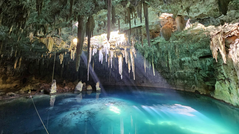
Cenote XCANAHALTUN, Temozon, Yucatan, Mexico
Cenote XCANAHALTUN, Temozon, Yucatan, Mexico
Formation of Solution Caves
- 1. Epigenic Processes (Surface-Driven)
- Rainwater absorbs carbon dioxide (CO₂) from the atmosphere and soil, forming weak carbonic acid.
- This acidic water percolates through cracks in the rock, gradually dissolving calcium carbonate (the primary component of limestone).
- Over thousands to millions of years, the dissolution enlarges these cracks into voids, which can eventually develop into extensive cave systems.
- Examples of features formed by this process include underground rivers, sinkholes, and interconnected passages.
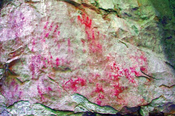
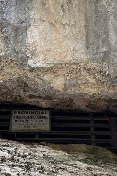
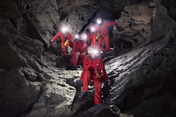
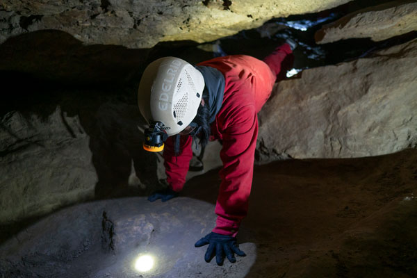
- This is the process in which Rat's Nest Cave was formed!
- 2. Hypogenic Processes (Subsurface-Driven)
- In some cases, caves form deep below the surface when water rich in hydrogen sulfide (H₂S) rises from deeper rock layers.
- This water reacts with oxygen to form sulfuric acid, which is much stronger than carbonic acid.
- The sulfuric acid aggressively dissolves rock from below, creating large chambers and unusual formations.
- A well-known example of this process is Carlsbad Caverns in New Mexico, USA.
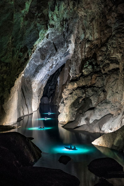
Variants of Solution Caves
- Cenotes:
- Sinkholes filled with water that form when the roof of a limestone cave collapses.
- Common in regions with extensive limestone bedrock, such as the Yucatán Peninsula in Mexico.
- Often connected to underwater cave systems and are culturally significant to the Maya civilization.
- Gypsum Caves:
- Formed in areas where gypsum, a highly soluble mineral, is present.
- Tend to develop unique formations due to the softer nature of the rock.
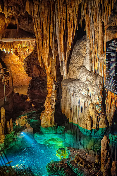
Features of Solution Caves
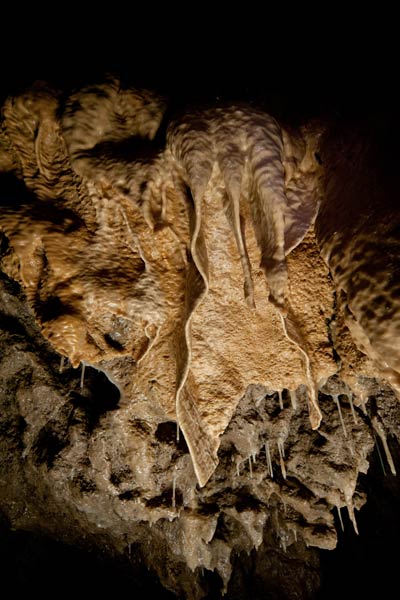
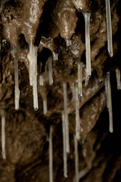
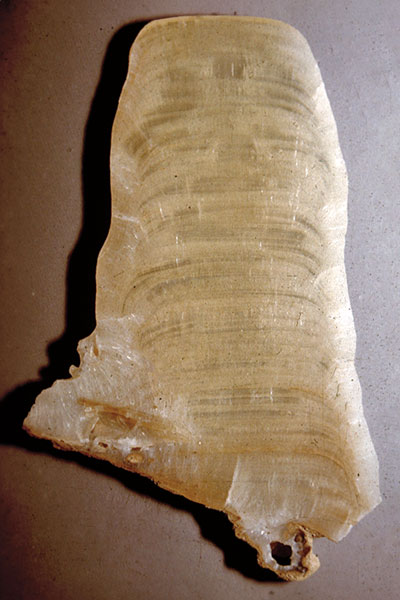
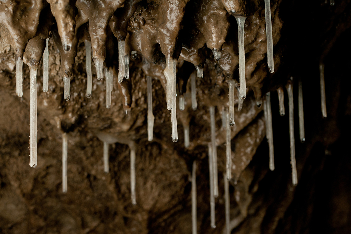
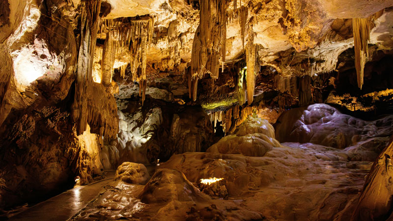
Solution caves are characterized by a wide variety of formations, or speleothems, which develop as dissolved minerals are redeposited by dripping or flowing water:
- Stalactites: Icicle-like formations hanging from the ceiling.
- Stalagmites: Pillar-like formations growing upward from the floor.
- Flowstones: Sheet-like deposits created by water flowing over walls or floors.
- Columns: Formed when stalactites and stalagmites meet.
These features add to the visual and geological complexity of solution caves, making them some of the most studied and visited cave types.
Interesting Facts
- Solution caves can take millions of years to form but may grow more rapidly in regions with high rainfall or active tectonic uplift.
- The world’s largest known cave, Son Doong in Vietnam, is a solution cave formed in limestone. Its main chamber is so vast that it contains its own weather system.
- Many prehistoric human artifacts and fossils have been discovered in solution caves, highlighting their importance as shelters and sites of human activity.
Chemical processes have shaped some of the most intricate and awe-inspiring caves on Earth.
Son Doong: The World's Largest Cave
Hidden in the dense jungles of Phong Nha-Ke Bang National Park in central Vietnam lies Son Doong Cave, a geological marvel and the largest known cave in the world. Discovered relatively recently, in 1991 by a local farmer and officially explored in 2009, this colossal cave has captured global attention for its extraordinary size, unique ecosystem, and breathtaking formations. Translating to “Mountain River Cave” in Vietnamese, Son Doong is not just a natural wonder but also a testament to the incredible forces of geology.
Son Doong was formed roughly 2-5 million years ago through the dissolution of limestone, a process common to solution caves. An underground river gradually carved through the soft rock, creating vast chambers. In some places, the cave’s ceiling collapsed, forming large skylights that allow sunlight to penetrate the darkness.
The cave remained hidden for millions of years, unknown even to the local population. It wasn’t until 1991 that a local farmer, Ho Khanh, stumbled upon its entrance while seeking shelter from a storm. The sound of wind whistling through the massive opening and the sight of a dense mist intrigued him, but it wasn’t until 2009 that the British Cave Research Association, led by Howard Limbert, conducted a formal expedition to map and explore Son Doong.
Son Doong is not just notable for its size; its ecosystem and formations are equally remarkable. The cave houses a thriving, self-contained environment with lush vegetation growing near the skylights. This “jungle within a cave” includes towering trees, moss, and ferns. Animal life, such as flying foxes and cave-dwelling insects, has adapted to the unique conditions of this subterranean world.
In addition to its ecosystem, Son Doong is home to breathtaking formations, including some of the world’s largest stalagmites, which rise up to 70 meters (230 feet) tall. Enormous cave pearls—formed by the gradual deposition of calcium carbonate around grains of sand—litter the cave floor. The underground river that helped carve the cave still flows, adding to its dynamic landscape.
Son Doong is a treasure not only for geologists and adventurers but also for Vietnam’s tourism industry. Strict regulations are in place to limit the number of visitors and ensure the cave’s pristine condition is preserved. Access to the cave is managed through guided tours, which are both physically demanding and environmentally conscious.
Son Doong stands as a symbol of the Earth’s untamed beauty, offering a glimpse into a hidden world shaped by natural forces over millions of years. Its discovery and exploration have deepened our understanding of caves and the ecosystems they harbor, cementing its place as one of the planet’s most awe-inspiring natural wonders.
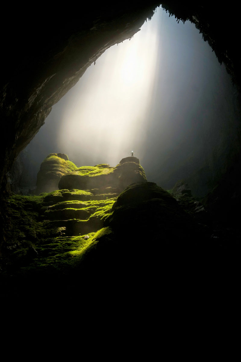
Son Doong’s dimensions are staggering, with its largest chamber stretching over 5 kilometers (3.1 miles) in length, 200 meters (656 feet) in height, and 150 meters (492 feet) in width. This means that it could comfortably fit an entire New York City block, complete with skyscrapers, inside its cavernous interior. Its volume is so vast that it has its own localized weather system, with clouds and mist forming due to temperature and humidity differences between the cave and the outside environment. Son Doong is approximately twice the size of its closest rival, Deer Cave in Malaysia, making it the undisputed giant of the underground world.
Caves Formed by Volcanism
Caves formed by volcanism, most notably lava tubes, are created during volcanic eruptions when molten lava flows and cools in specific ways. These caves are significantly different from those formed by chemical or mechanical processes, both in their formation mechanisms and their unique characteristics. Unlike many other cave types that take millennia to develop, lava tubes can form rapidly, sometimes in just days or weeks.
-
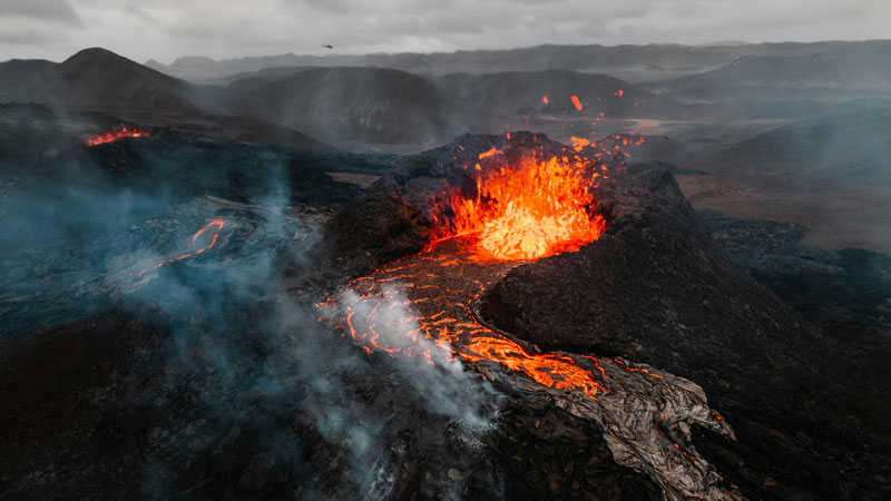
Volcano Erupting In Iceland With Lava Flowing
Volcano Erupting In Iceland
-
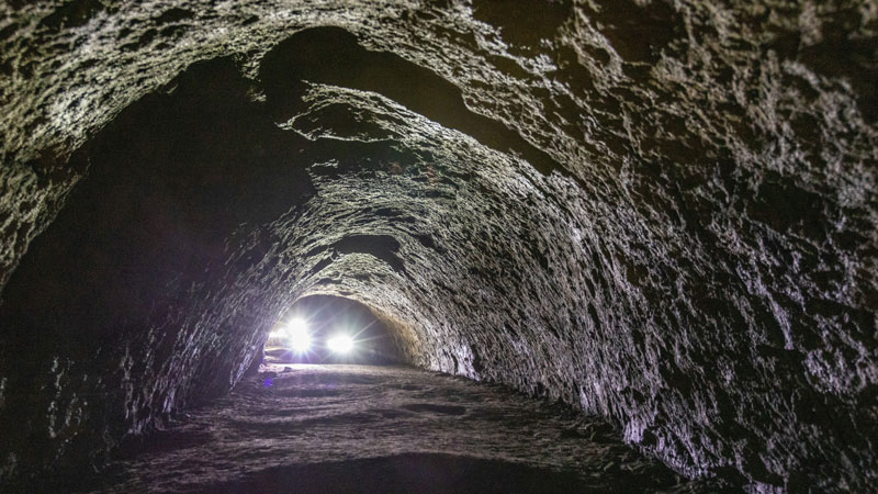
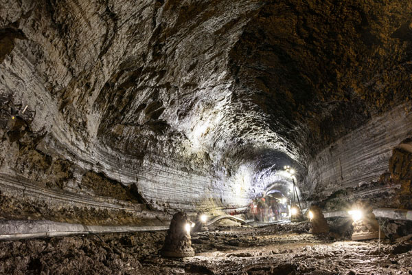
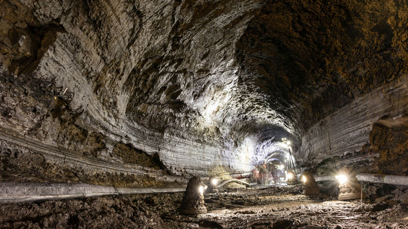
Lava River Cave Bend Oregon
Lava River Cave Bend Oregon
Formation of Lava Tubes
Lava tubes form during the eruption of basaltic lava, which is low in viscosity and can flow long distances before solidifying. The process unfolds in two key stages:
- 1. Surface Cooling
- As lava flows downhill, its surface begins to cool and solidify upon exposure to the air. This creates a solid crust that insulates the molten lava beneath, allowing it to remain fluid.
- 2. Lava Drainage
- Once the eruption subsides or the lava supply decreases, the molten lava drains out of the tube, leaving a hollow conduit. These tubes can extend for many kilometers, depending on the eruption’s duration and the lava’s properties.
Examples and Global Distribution
Lava tubes are most common in regions with basaltic volcanism. They are found in volcanic landscapes worldwide, with notable examples including:
- Hawaii: The Hawaiian Islands, particularly the Big Island, are home to some of the most extensive and well-preserved lava tubes.
- Iceland: Known for its basaltic terrain, Iceland features numerous lava tubes accessible for exploration.
- Pacific Northwest, USA: Lava tubes can be found in volcanic areas such as Oregon and Washington, formed during ancient eruptions.
Features of Lava Tubes
Lava tubes are distinct from other cave types due to their smooth, rounded structures and specific volcanic features:
- Smooth or Rippled Walls: The flowing lava leaves behind smooth walls, often marked by ripples or ridges.
- Ropey Lava (Pāhoehoe Texture):Common in regions with extensive limestone bedrock, such as the Yucatán Peninsula in Mexico.
- Skylights:Portions of the tube’s roof may collapse, creating openings to the surface. These skylights provide natural access points and allow light to penetrate the otherwise dark caves.
- Multi-Level Structures:In some cases, lava tubes form on multiple levels as subsequent lava flows carve new conduits above or below older ones.
Importance of Lava Tubes
Lava tubes are valuable not only for their geological significance but also for their potential applications and ecological importance:
- Geological Insights: Lava tubes provide a record of volcanic activity, helping scientists understand eruption patterns and predict future events.
- Ecosystems: Some lava tubes host unique ecosystems, with species adapted to the stable temperatures and complete darkness of these environments.
- Space Exploration: Similar structures have been identified on the Moon and Mars. Studying Earth’s lava tubes helps scientists explore their potential as habitats for future space missions.
Interesting Facts
- The longest known lava tube is Kazumura Cave in Hawaii, which stretches over 65 kilometers (40 miles).
- Lava tubes can remain geothermally active long after their formation, creating warm, steamy conditions in some areas.
- Many lava tubes have historical significance, serving as shelters, burial sites, or ceremonial spaces for ancient peoples.
Caves formed by volcanism are a testament to the dynamic forces shaping Earth’s surface. Their rapid formation, unique features, and scientific importance make lava tubes a fascinating subject of study and a key part of the diverse world of caves.
Caves Formed by Mechanical Processes
Caves formed by mechanical processes result from physical forces acting on rock and sediment. Unlike chemical or volcanic caves, these caves are created when rock is eroded, broken, or displaced without any significant chemical alteration. Mechanical caves include a variety of types, such as sea caves, talus caves, tectonic caves, eolian caves, and frost pockets, each shaped by different forces and environmental conditions.
Sea Caves (Littoral Caves):
Sea caves form along coastlines, where wave action erodes rock over time. These caves are most common in cliffs made of softer or fractured rock types, which are more vulnerable to the relentless pounding of waves.
- Formation: Waves exploit weaknesses in the rock, such as cracks or faults, gradually enlarging them into voids. Over time, these voids expand into chambers or tunnel-like passages.
- Characteristics:
- Often found near sea level and shaped by tides.
- Can feature smooth walls or jagged edges, depending on the rock type.
- Interesting Fact: Sea caves are often temporary structures, as ongoing erosion can eventually cause them to collapse.
-

A Sea Cave
-
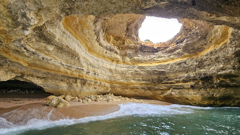
Benagil Sea Cave, Lagoa, Portugal
Benagil Sea Cave, Lagoa, Portugal
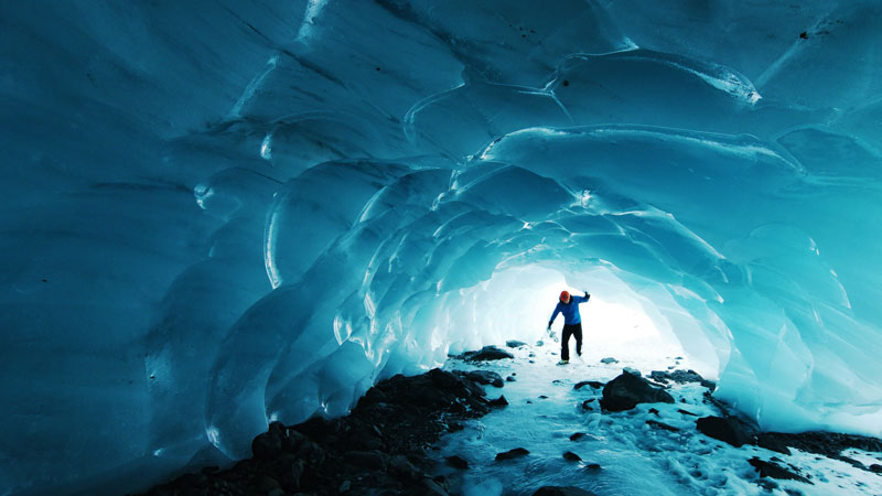
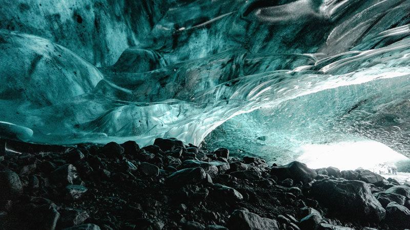
Glacier Caves:
Glacier caves, often referred to as ice caves, are naturally occurring voids that form within glaciers or permanent ice fields. These caves are dynamic and constantly changing due to the movement and melting of the ice.
- Formation: Glacier caves are typically formed by meltwater streams running through or beneath a glacier. The water gradually carves out tunnels and chambers as it flows, aided by the heat from the surrounding environment. In some cases, geothermal heat or volcanic activity beneath a glacier can accelerate the melting process, forming what are known as **glacio-volcanic caves**.
- Characteristics:
- Highly dynamic, with structures that can change seasonally or even daily.
- Often feature stunning blue ice walls, caused by the compaction of ice filtering out all but blue light.
- Typically found in polar or high-altitude regions, or near volcanic activity.
- Interesting Fact: Glacio-volcanic caves, such as those formed on glaciers atop Icelandic volcanoes, offer a rare combination of ice and geothermal features, making them unique geological environments.
-
Byron Glacier Cave, Chugach National Forest, Seward, United States
Byron Glacier Cave, Chugach National Forest, Seward, United States
-
Glacier Cave, Jokulsarlon, Iceland
Glacier Cave, Jokulsarlon, Iceland
Talus Caves:
Talus caves form when large boulders or rock fragments accumulate on slopes, creating spaces and voids between them. These caves are common in areas with steep cliffs or mountains where rockfalls occur.
- Formation: As rocks fall and pile up, they leave behind interconnected gaps that create a network of small passages.
- Characteristics:
- Typically irregular in shape and limited in size.
- Less extensive than other cave types, but often accessible and stable.
- Interesting Fact: Talus caves often serve as habitats for wildlife, such as bats and small mammals, and were occasionally used as shelters by early humans.
Tectonic (Fracture) Caves:
Tectonic caves form due to the movement of Earth’s crust, creating voids along faults or fractures. Unlike other caves, these are not carved or eroded but result from shifts in rock layers.
- Formation:Movements such as earthquakes or gradual tectonic activity cause large sections of rock to separate, leaving open spaces.
- Characteristics:
- Irregular and jagged passages.
- Found in seismically active regions or areas with significant crustal stress.
- Interesting Fact: These caves are often associated with geologic features like fault lines or escarpments.
Eolian Caves:
Eolian caves are formed by wind erosion in arid environments. Over time, windblown sand or dust scours away softer rock, creating cavities and voids.
- Formation: Wind carries abrasive particles that grind away at rock surfaces, particularly in soft sandstone or other porous materials.
- Characteristics:
- Often found in desert regions.
- Typically smaller and less extensive but visually striking, with smooth, sculpted walls.
- Interesting Fact: Eolian caves are not only geological features but also indicators of past wind patterns and environmental conditions.
Frost Pockets (Pseudo-Caves):
Frost pockets are a type of pseudo-cave created by freeze-thaw cycles. While not true caves, they resemble caves in appearance and are often found in cold climates.
- Formation:Water seeps into cracks in rock, freezes, and expands, breaking the rock apart. Over time, this process creates cavities or enlarges existing ones.
- Characteristics:
- Typically small and irregular.
- Found in regions with significant seasonal temperature fluctuations.
- Interesting Fact: Frost pockets provide valuable evidence of historical climate conditions and freeze-thaw processes.
Mechanical caves demonstrate the power of physical forces in shaping Earth’s surface. While they may not be as vast or intricate as caves formed by chemical or volcanic processes, they reveal the dynamic interactions between geology and the environment. These caves, whether carved by waves, wind, or tectonic activity, add to the diverse tapestry of Earth’s underground landscapes.
Caves are a testament to the dynamic forces shaping our planet. From the slow dissolution of rock by chemical processes to the rapid creation of lava tubes during volcanic eruptions, and the physical sculpting by waves, wind, and tectonic movements, each type of cave offers a unique insight into Earth’s geology. Even within a single category, the variations in size, shape, and formation mechanisms highlight the complexity and diversity of these natural structures
Understanding how caves form helps us appreciate their role in Earth’s history and ecosystems. Whether carved by water, forged by fire, or shaped by physical forces, caves are more than just underground voids—they are records of geological time, habitats for unique species, and natural wonders that inspire curiosity and exploration.